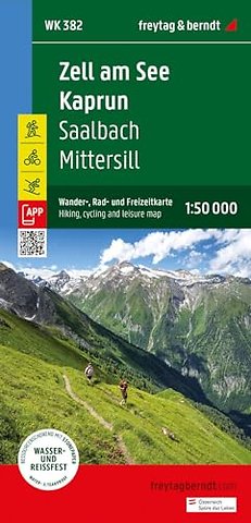
Zell am See Kaprum Hikin, Cycling & Leisure Map
WK 382 1:50,000
Onbekend EN 2024 9783707922110Samenvatting
Thanks to the detailed digital cartography and the precise scales, freytag & berndt hiking maps are ideal companions for hiking, mountaineering and ski tours. They are regularly revised and contain updated information on hiking trails, cycling and mountain biking routes, huts, natural monuments, cultural sights and leisure facilities. The enclosed information booklet offers a selection of the best hiking trails, cycle paths and mountain bike routes as well as a brief description of the individual communities and their leisure activities. (Language: German) Leisure information, hiking and long-distance hiking trails, mountain bike and cycling tours, register of places with postcodes, GPS-compatible, via ferrata, ski route, cross-country route, Nordic walking route; Region: Hohe Tauern, Pinzgau, Salzburg; Special themed hiking trails: Central Alpine Trail, Arno Trail, King's Trail, Bach educational trail in the Vorderen Hollersbachtal, Austria Trail on the Mooserboden, hike to the Walcher waterfall, Kasereck - Kreuzköpfl summit tour, summit hike around the Torsee, Kohlmais circular tour; Special bike tours: Tauern cycle path, Watzmann-Hochkönig tour, Stubach valley panoramic road, Fuschertörl, Ellmaualm-Zwölferkogel tour; Environment maps: WK 103, WK 120, WK 121, WK 123, WK 191, WK 301, WK 393;
Specificaties
Lezersrecensies
Rubrieken
- advisering
- algemeen management
- coaching en trainen
- communicatie en media
- economie
- financieel management
- inkoop en logistiek
- internet en social media
- it-management / ict
- juridisch
- leiderschap
- marketing
- mens en maatschappij
- non-profit
- ondernemen
- organisatiekunde
- personal finance
- personeelsmanagement
- persoonlijke effectiviteit
- projectmanagement
- psychologie
- reclame en verkoop
- strategisch management
- verandermanagement
- werk en loopbaan