Thomas Lillesand,
Ralph Kiefer,
Jonathan Chipman
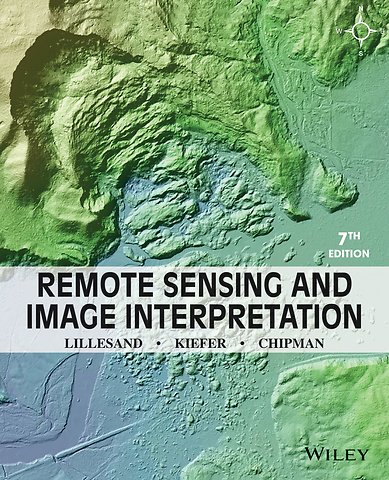
Remote Sensing and Image Interpretation
Paperback Engels 2015 7e druk 9781118343289Levertijd ± 8 werkdagen
Gratis verzonden
Samenvatting
Remote Sensing and Image Interpretation, 7th Edition is designed to be primarily used in two ways: as a textbook in the introductory courses in remote sensing and image interpretation, and as a reference for the burgeoning number of practitioners who use geospatial information and analysis in their work. Because of the wide range of academic and professional settings in which this book might be used, we have made the discussion discipline neutral. In short, anyone involved in geospatial data acquisition and analysis should find this book to be a valuable text and reference.
Specificaties
ISBN13:9781118343289
Taal:Engels
Bindwijze:paperback
Aantal pagina's:736
Uitgever:John Wiley & Sons
Druk:7
Verschijningsdatum:17-3-2015
Hoofdrubriek:Wetenschap en techniek
Lezersrecensies
Wees de eerste die een lezersrecensie schrijft!
Inhoudsopgave
1 Concepts and Foundations of Remote Sensing 1
1.1 Introduction 1
1.2 Energy Sources and Radiation Principles 4
1.3 Energy Interactions in the Atmosphere 9
1.4 Energy Interactions with Earth Surface Features 12
1.5 Data Acquisition and Digital Image Concepts 30
1.6 Reference Data 39
1.7 The Global Positioning System and Other Global Navigation Satellite Systems 43
1.8 Characteristics of Remote Sensing Systems 45
1.9 Successful Application of Remote Sensing 49
1.10 Geographic Information Systems (GIS) 52
1.11 Spatial Data Frameworks for GIS and Remote Sensing 57
1.12 Visual Image Interpretation 59
2 Elements of Photographic Systems 85
2.1 Introduction 85
2.2 Early History of Aerial Photography 86
2.3 Photographic Basics 89
2.4 Film Photography 99
2.5 Digital Photography 115
2.6 Aerial Cameras 118
2.7 Spatial Resolution of Camera Systems 136
2.8 Aerial Videography 143
2.9 Conclusion 145
3 Basic Principles of Photogrammetry 146
3.1 Introduction 146
3.2 Basic Geometric Characteristics of Aerial Photographs 150
3.3 Photographic Scale 159
3.4 Ground Coverage of Aerial Photographs 164
3.5 Area Measurement 167
3.6 Relief Displacement of Vertical Features 170
3.7 Image Parallax 177
3.8 Ground Control for Aerial Photography 188
3.9 Determining the Elements of Exterior Orientation of Aerial Photographs 189
3.10 Production of Mapping Products from Aerial Photographs 194
3.11 Flight Planning 210
3.12 Conclusion 217
4 Multispectral, Thermal, and Hyperspectral Sensing 218
4.1 Introduction 218
4.2 Across–Track Scanning 219
4.3 Along–Track Scanning 225
4.4 Example Across–Track Multispectral Scanner and Imagery 226
4.5 Example Along–Track Multispectral Scanner and Imagery 230
4.6 Geometric Characteristics of Across–Track Scanner Imagery 232
4.7 Geometric Characteristics of Along–Track Scanner Imagery 241
4.8 Thermal Imaging 243
4.9 Thermal Radiation Principles 245
4.10 Interpreting Thermal Imagery 254
4.11 Radiometric Calibration of Thermal Images and Temperature Mapping 265
4.12 FLIR Systems 269
4.13 Hyperspectral Sensing 271
4.14 Conclusion 282
5 Earth Resource Satellites Operating in the Optical Spectrum 283
5.1 Introduction 283
5.2 General Characteristics of Satellite Remote Sensing Systems Operating in the Optical Spectrum 285
5.3 Moderate Resolution Systems 295
5.4 Landsat–1 to –7 296
5.5 Landsat–8 309
5.6 Future Landsat Missions and the Global Earth Observation System of Systems 322
5.7 SPOT–1 to –5 324
5.8 SPOT–6 and –7 336
5.9 Evolution of Other Moderate Resolution Systems 339
5.10 Moderate Resolution Systems Launched prior to 1999 340
5.11 Moderate Resolution Systems Launched since 1999 342
5.12 High Resolution Systems 349
5.13 Hyperspectral Satellite Systems 356
5.14 Meteorological Satellites Frequently Applied to Earth Surface Feature Observation 359
5.15 NOAA POES Satellites 360
5.16 JPSS Satellites 363
5.17 GOES Satellites 366
5.18 Ocean Monitoring Satellites 367
5.19 Earth Observing System 371
5.20 Space Station Remote Sensing 379
5.21 Space Debris 382
6 Microwave and Lidar Sensing 385
6.1 Introduction 385
6.2 Radar Development 386
6.3 Imaging Radar System Operation 389
6.4 Synthetic Aperture Radar 399
6.5 Geometric Characteristics of Radar Imagery 402
6.6 Transmission Characteristics of Radar Signals 409
6.7 Other Radar Image Characteristics 413
6.8 Radar Image Interpretation 417
6.9 Interferometric Radar 435
6.10 Radar Remote Sensing from Space 441
6.11 Seasat–1 and the Shuttle Imaging Radar Missions 443
6.12 Almaz–1 448
6.13 ERS, Envisat, and Sentinel–1 448
6.14 JERS–1, ALOS, and ALOS–2 450
6.15 Radarsat 452
6.16 TerraSAR–X, TanDEM–X, and PAZ 455
6.17 The COSMO–SkyMed Constellation 457
6.18 Other High–Resolution Spaceborne Radar Systems 458
6.19 Shuttle Radar Topography Mission 459
6.20 Spaceborne Radar System Summary 462
6.21 Radar Altimetry 464
6.22 Passive Microwave Sensing 466
6.23 Basic Principles of Lidar 471
6.24 Lidar Data Analysis and Applications 475
6.25 Spaceborne Lidar 482
7 Digital Image Analysis 485
7.1 Introduction 485
7.2 Preprocessing of Images 488
7.3 Image Enhancement 500
7.4 Contrast Manipulation 501
7.5 Spatial Feature Manipulation 507
7.6 Multi–Image Manipulation 517
7.7 Image Classification 537
7.8 Supervised Classification 538
7.9 The Classification Stage 540
7.10 The Training Stage 546
7.11 Unsupervised Classification 556
7.12 Hybrid Classification 560
7.13 Classification of Mixed Pixels 562
7.14 The Output Stage and Postclassification Smoothing 568
7.15 Object–Based Classification 570
7.16 Neural Network Classification 573
7.17 Classification Accuracy Assessment 575
7.18 Change Detection 582
7.19 Image Time Series Analysis 587
7.20 Data Fusion and GIS Integration 591
7.21 Hyperspectral Image Analysis 598
7.22 Biophysical Modeling 602
7.23 Conclusion 608
8 Applications of Remote Sensing 609
8.1 Introduction 609
8.2 Land Use/Land Cover Mapping 611
8.3 Geologic and Soil Mapping 618
8.4 Agricultural Applications 628
8.5 Forestry Applications 632
8.6 Rangeland Applications 638
8.7 Water Resource Applications 639
8.8 Snow and Ice Applications 649
8.9 Urban and Regional Planning Applications 652
8.10 Wetland Mapping 654
8.11 Wildlife Ecology Applications 658
8.12 Archaeological Applications 662
8.13 Environmental Assessment and Protection 665
8.14 Natural Disaster Assessment 668
8.15 Principles of Landform Identification and Evaluation 678
8.16 Conclusion 697
Works Cited 699
Index 709
SI Units Frequently Used in Remote Sensing 720
Appendices Available online at www.wiley.com/college/lillesand
Appendix A: Radiometric Concepts, Terminology, and Units
Appendix B: Sample Coordinate Transformation and Resampling Procedures
Appendix C: Radar Signal Concepts, Terminology, and Units
Afgekapt op 60 regels
Anderen kochten ook
 Robert Heath€ 95,55
 Simon University) Haykin€ 83,33
Rubrieken
- advisering
- algemeen management
- coaching en trainen
- communicatie en media
- economie
- financieel management
- inkoop en logistiek
- internet en social media
- it-management / ict
- juridisch
- leiderschap
- marketing
- mens en maatschappij
- non-profit
- ondernemen
- organisatiekunde
- personal finance
- personeelsmanagement
- persoonlijke effectiviteit
- projectmanagement
- psychologie
- reclame en verkoop
- strategisch management
- verandermanagement
- werk en loopbaan