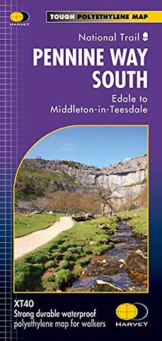
Pennine Way South
Edale to Middleton-in-Teesdale
Onbekend EN 2019 9781851376162Levertijd ongeveer 11 werkdagen
Gratis verzonden
Samenvatting
Now printed on 100% waterproof and practically indestructable polyethelene paper. Weighing half the weight of a laminated map this updated map from Edale to Middleton-in-Teesdale is the Southern part of the popular Pennine Way. The Pennine Way is a National Trail. It follows the backbone of England from the Peak District to the Scottish borders. It is one of the toughest UK long distance footpaths, and forms part of the European Footpath Network. The Pennine Way was Britain's first National Trail, opened in 1965. Just 2 HARVEY maps cover the whole 268-mile route. Each covers a section of the Way suitable for a comfortable week of walking. Each starts and finishes near public transport.
Specificaties
ISBN13:9781851376162
Taal:EN
Bindwijze:onbekend
Aantal pagina's:1
Uitgever:Harvey Map Services Ltd
Serie:Trail Maps XT40
Lezersrecensies
Wees de eerste die een lezersrecensie schrijft!
Rubrieken
- advisering
- algemeen management
- coaching en trainen
- communicatie en media
- economie
- financieel management
- inkoop en logistiek
- internet en social media
- it-management / ict
- juridisch
- leiderschap
- marketing
- mens en maatschappij
- non-profit
- ondernemen
- organisatiekunde
- personal finance
- personeelsmanagement
- persoonlijke effectiviteit
- projectmanagement
- psychologie
- reclame en verkoop
- strategisch management
- verandermanagement
- werk en loopbaan