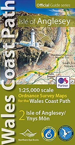
Isle of Anglesey Coast Path Map (WCP)
1:25 000 scale OS mapping for the Isle of Anglesey WCP
Paperback EN 2019 9781908632593Levertijd ± 11 werkdagen
Samenvatting
Enhanced, large scale (1: 25,000) Ordnance Survey mapping in a handy atlas format with all the mapping you need to walk a complete circuit of the Anglesey section of the Wales Coast Path. Continuous OS mapping covering the complete circuit from Menai Bridge. Contains coastal extracts from large scale Explorer maps 262 and 263. - Large scale Ordnance Survey mapping for the complete circuit of the Isle of Anglesey in a handy atlas format. - Highlighted official route of the Wales Coast Path/ Anglesey Coastal Path. - On-map symbols showing amenities at main towns and villages. - Introduction with attractive photo mosaic. - Additional useful information
Specificaties
ISBN13:9781908632593
Taal:EN
Bindwijze:Paperback
Aantal pagina's:48
Uitgever:Northern Eye Books
Thema:
Lezersrecensies
Wees de eerste die een lezersrecensie schrijft!
Rubrieken
- advisering
- algemeen management
- coaching en trainen
- communicatie en media
- economie
- financieel management
- inkoop en logistiek
- internet en social media
- it-management / ict
- juridisch
- leiderschap
- marketing
- mens en maatschappij
- non-profit
- ondernemen
- organisatiekunde
- personal finance
- personeelsmanagement
- persoonlijke effectiviteit
- projectmanagement
- psychologie
- reclame en verkoop
- strategisch management
- verandermanagement
- werk en loopbaan